Digital Tools

Digital Tools for Cultural Heritage Management


Date: Summer 2027 – Exact dates TBC
Location:
Hybrid Training Program
Tolo, Nafplio, Greece in person & online


Application Deadline:

31 January 2027

MORE INFO


APPLY NOW

Vacancies for this Summer Field School Program are limited, so please apply early.

Project Director:

Dr Evangelos Kyriakidis, HERITΛGE Director


Instructors:

Dr Cornelis Stal, Lecturer/Researcher, HOGENT, HERITΛGE Digital Manager
Cornelis is a lecturer and researcher at the University College Ghent and Ghent University (Belgium), where he is working on surveying engineering, geomatics and image-based 3D modelling. Within the framework of his research, he has participated in various archaeological and anthropological field campaigns, where the topics of this workshop are empirically implemented in an interdisciplinary context.

Supported by:


HERITΛGE, in close collaboration with HOGENT University (Belgium) has organized three integrated and consecutive specialist courses in geomatic topics to assist heritage managers in their work:
• GIS
• Photogrammetry and image-based 3D modelling
• Terrestrial laser scanning
 
* Please note that these specialist courses can be booked individually. For those intending to just do sections of the field summer school, please contact at the email [email protected] for further information and arrangements.
 
 
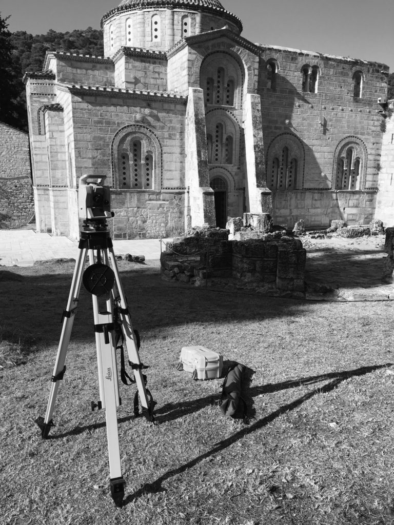
This field school will introduce students to a broad range of 3D recording and mapping techniques, as well as methodologies to use and analyze spatial data. Participants will be provided with hands-on instruction in these methods with hands-on demos and exercises at various study areas. These skills are essential in heritage management for any restoration, documentation or visualization project.
 

Online Training Schedule and Details:

During the online training period, each topic is covered by the participants in an asynchronous fashion, meaning that they will process the material and prepare the assignments individually.  At the end of each topic, an online Q&A/demo session will be organised. The content of these sessions will be based on questions and remarks submitted by the participants.

Both online courses will start with an introduction and a kickstart demo for the software.

All online sessions will take place on either Tuesday or Friday, making sure that there are either 3 or 4 days between each session.
For details on the themes taught and application procedures, see the official announcement of the workshop here.


On successfully completing the Summer School module on GIS students will be able to:
  • comprehend fundamental concepts and practices of GIS
  • use GIS software for spatial tasks
  • apply data styling and create labels (symbology)
  • apply data selections using attribute queries and spatial predicates
  • demonstrate proficiency in designing maps for the presentation of spatial data and
  • analysis results in particular, including historical, touristic, commercial, etc. maps
  • create new vector-based spatial data using desktop GIS software and field software
  • georeference manuscript maps and generate new spatial data
  • perform appropriate geoprocessing tools for complex spatial questions
On successfully completing the Summer School module on Photogrammetry online students will be able to:
  • understand principles of photography, photogrammetry, image-based 3D reconstruction
  • obtain photographs, aiming at the creation of an image-based 3D reconstruction
  • use software and hardware for the construction and processing of 3D models, orthophotos, and point clouds (photography, photogrammetry, 3D modelling and model referencing, and vectorization by covering the entire workflow from image acquisition via data processing to model publishing)
  • comprehend data processing, publishing 3D models (online, offline), and integrating image-based models in GIS.


On successfully completing the Summer School on Photogrammetry and Laser Scanning Field school students online students will be able to:
  • understand principles of photography, photogrammetry, image-based 3D reconstruction
  • obtain photographs, aiming at the creation of an image-based 3D reconstruction
  • use software and hardware for the construction and processing of 3D models, orthophotos, and point clouds (photography, photogrammetry, 3D modelling and model referencing, and vectorization by covering the entire workflow from image acquisition via data processing to model publishing)
  • comprehend data processing, publishing 3D models (online, offline), and integrating image-based models in GIS)
  • understand European regulation on the use of UAVs
  • use a UAV for the image-based reconstruction of a site or monument
  • understand the process of generating dense geometrical representations of objects using different types of laser scanning and accompanying field procedures
  • understand the principles of applying 3D recording of cultural sites
  • comprehend point cloud data processing: registration, filtering and data management, extraction of meaningful deliverables, publishing data using specialized software
  • apply procedures and techniques to optimize the acquisition and to generate deliverables (conventional maps, 3D models and online visualizations) covering heritage sites
  • work on complex 3D modelling tasks in a team
Newsletter Sign-up