Drones, digital tools, and archaeological research
By Dr Cornelis Stal
Spatial data play a crucial role in archaeological research, and orthophotos, digital elevation models, and 3D models are frequently used for the mapping, documentation, and monitoring of archaeological sites.
Over the last couple of decades, thanks to the availability of compact and low-cost uncrewed airborne vehicles also known as drones or unmanned aerial vehicles, the use of UAV-based photogrammetry in this field has significantly matured. More recently, compact airborne systems that allow the recording of thermal data, multispectral data, and airborne laser scanning also became available.
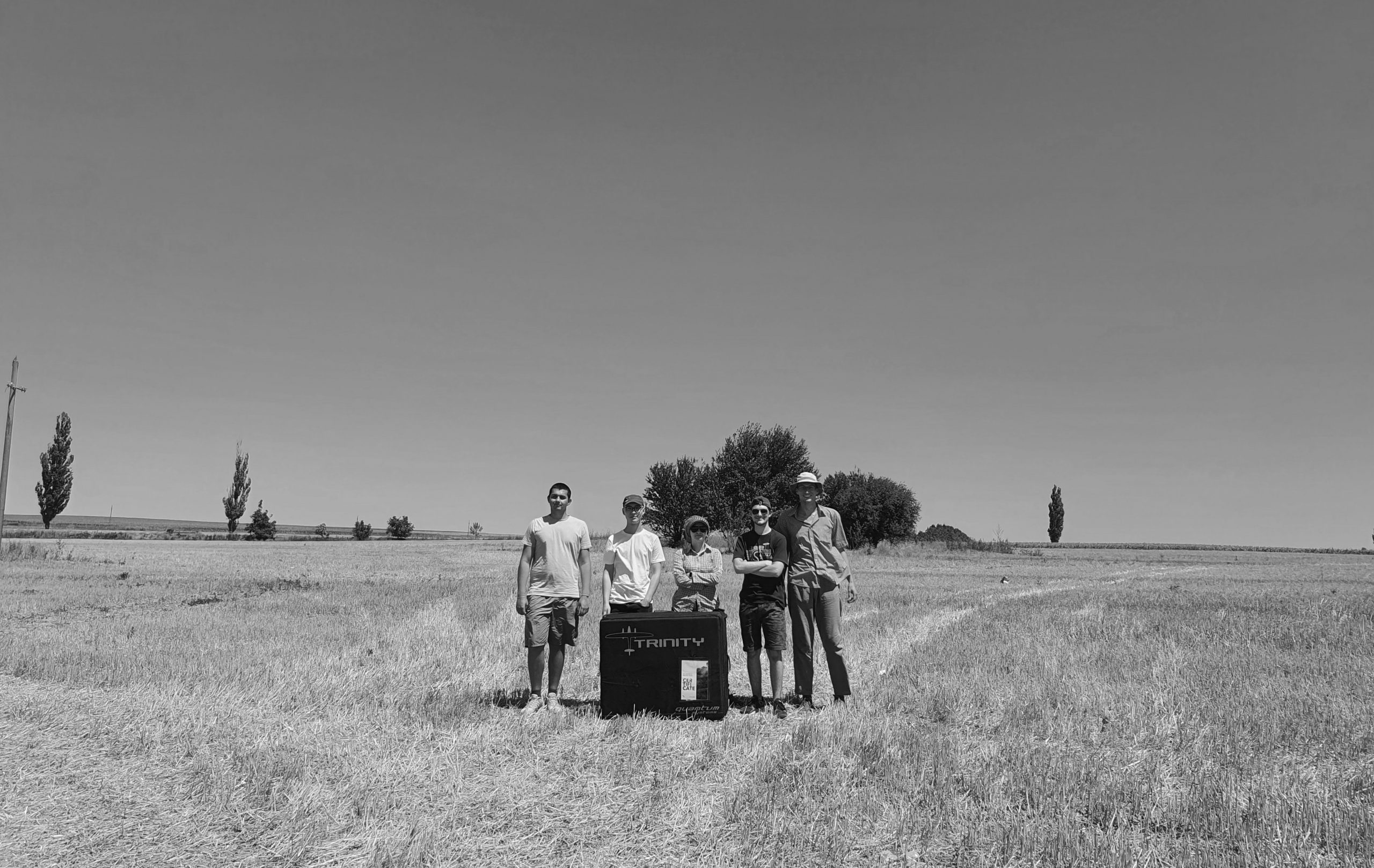
Recently, a team from HOGENT University of Applied Sciences and Arts, the University of Bucharest, Kiel University, the Lower Danube Museum Călărași, and the Municipality of Bucharest applied various platforms and sensors at the Chalcolithic archaeological sites in the Mostiștea Basin and Danube Valley (Southern Romania).
We then analyzed the performance of the systems and the resulting data and were given unique insights that enabled us to select the appropriate system for the right application.
This kind of analyses are based on thorough knowledge of data acquisition and data processing, as well. As laser scanning and photogrammetry typically result in very large amounts of data, a special focus is also required on the storage and publication of the data.
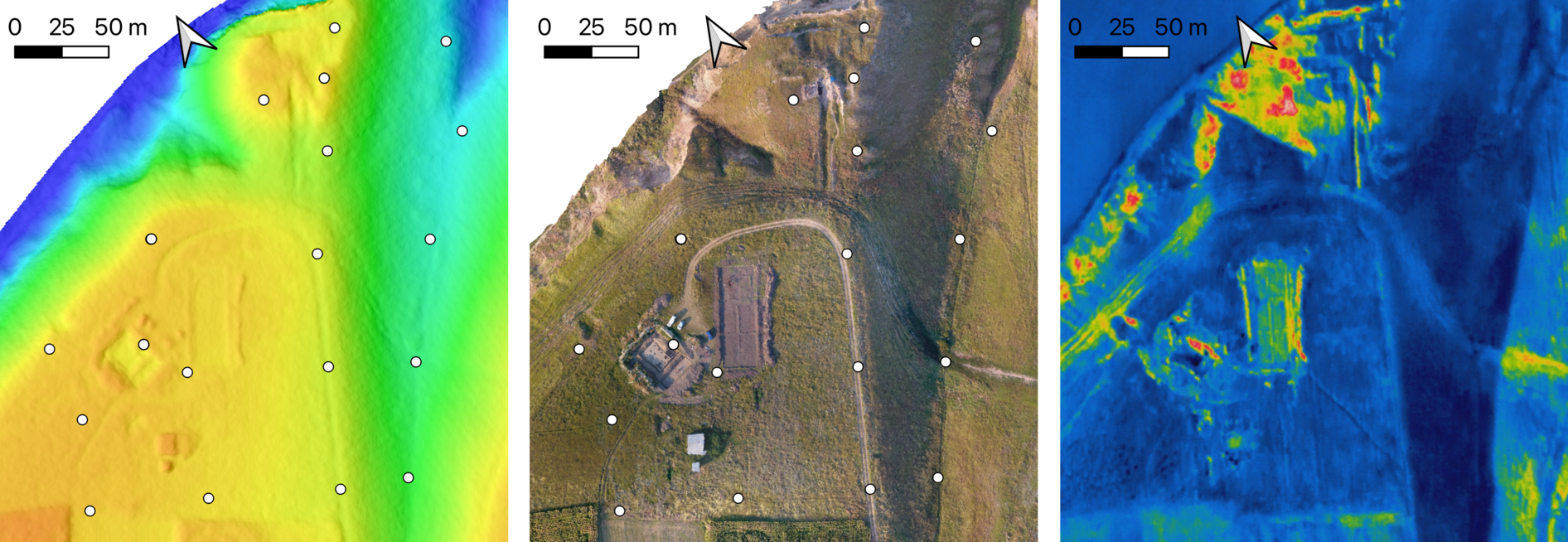
Sultana site: DEM (left), orthophoto (middle), and thermal composite (right) based on Mavic 2 Enterprise data of the archaeological site of Sultana (illustrative, the white dots represent the locations of the GCPs).
In a recently published article (reference below), the team provided an overview of various aspects of 3D data acquisition for UAV-based mapping and explored multiple methods for the online publication of data as well as various client-side and server-side solutions to make the data available for other researchers/users. Data are available through an academic open repository (https://zenodo.org/) and an in-house developed website (https://geo.hogent.be/sultana).
Based on our research, it is concluded that photogrammetry and laser scanning can result in data with similar geometrical properties when acquisition parameters are appropriately set. However, the used ALS-based system outperforms the photogrammetric platforms regarding operational time and the area covered. On the other hand, conventional photogrammetry provides flexibility that might be required for very low-altitude flights or emergency mapping. Furthermore, as the used ALS sensor only provides a geometrical representation of the topography, photogrammetric sensors are still required to obtain true color- or false color composites of the surface.
Undoubtedly, the resulting data will serve as the basis for a more in-depth understanding of the complex natural and anthropogenic processes that are documented in the targeted area, and the non-intrusive investigations and the logs from “The dynamics of the prehistoric communities located in the Mostiștea Valley and Danube Plain (between Oltenița and Călărași)” project will provide complementary data for this broader understanding of the prehistoric realities. More specifically, this approach contributes to the research on transformative processes of the archaeological sites and the landscape from proximity, enabling us to create a highly accurate image of the scale of transformation of the area inhabited 6000 years ago by various human communities in order to better understand how Chalcolithic human communities integrated, adapted, and survived in the surrounding environment.

Chiselet site: Hillshade DEM (left) and false colour composite (right) of the larger extent of the tell settlement (coordinates in EPSG:3844).
Finally, with spatial data playing a crucial role in archaeological research, and orthophotos, digital elevation models, and 3D models being frequently used for the mapping, documentation, and monitoring of archaeological sites, we concluded that recent developments in UAVs and compact sensors have and will have a considerable impact on archaeological research.
In conclusion, it is stated that applications of geomatics in archaeology contribute to a better understanding and knowledge of various research topics, and the connection between these two disciplines strengthens as data acquisition methods and data processing capabilities evolve.
We explore these methods and tools and instruct our students in their use in HERITΛGE’s Digital Tools for Cultural Heritage Summer School which takes place online and on location in Greece in a few months, and in the ECTS credit-bearing academic certificate that HOGENT UNIVERSITY and HERITΛGE are offering – applications for 2023-2024 academic years are currently being accepted (more information here.)
I and the HERITΛGE and HOGENT teams look forward to meeting and working with a new cohort of students this summer and in the new academic year to further explore the possibilities of these ever-evolving methods.
Stal, C., Covataru, C., Müller, J., Parnic, V., Ignat, T., Hofmann, R., & Lazar, C. (2022). Supporting Long-Term Archaeological Research in Southern Romania Chalcolithic Sites Using Multi-Platform UAV Mapping. Drones, 6(10), 277: https://www.mdpi.com/2504-446X/6/10/277
Website: https://geo.hogent.be/sultana
Data repository: https://zenodo.org/search?page=1&size=20&q=%22Mosti%C8%99tea%20Valley%22