Overview

Digital Tools for Cultural Heritage Management | Overview


This program introduces you to a broad range of 3D recording and mapping techniques, as well as to methodologies on how to use and analyze spatial data. Furthermore, you will be introduced to the field of managing various aspects of the cultural heritage you will be studying. You will be provided with hands-on instruction in these methods with hands-on demos and exercises in various study areas. GIS will be used to publish the data in cartographic outputs, and to use spatial data for management and analysis of the features under study. Heritage management introduction allows you to get a better understanding of the objects and to facilitate the discussion and process of using these data for the preservation and exploitation of heritage assets for the benefit of communities.

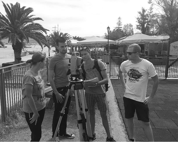
This is an asynchronous program with a multitude of optional live classes. During the online program, you will work on provided data, but you will also record your own data and use online spatial data sources for your own projects. These data will be processed with the appropriate software.

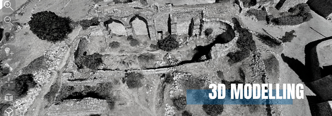
Finally, laser scanning data (point clouds) will be provided by the instructors for further processing, whereas image-based 3D models will be generated soon after the start of the program. During fieldwork, we will focus on the entire workflow from data acquisition to data publication.

STRUCTURE


The program will take place during the Autumn semester, starting from early October until the winter break. A large amount of asynchronous course material about GIS, data acquisition and processing, as well as heritage management is offered through our online eLearning platform, while a series of optional live sessions and tutorials will be presented by our team. At the end of October and until the beginning of November a credit-bearing 10-day fieldwork campaign will be organized in Greece.

During our fieldwork, digital cameras, laser scanners, and UAVs will be used to obtain skills on advanced data acquisition.

TEACHING METHODS


Sessions are primarily organized online via asynchronous pre-recorded sessions and optional live ones, together with online materials and exercises. Practical sessions, Q&A meetings, and moments for discussion and debate are also scheduled.

As a participant, you will directly implement the newly obtained skills by using them during the course on your own cultural heritage projects.

A laptop, internet connection, and a digital camera (SLR camera, compact camera, or a smartphone) will be the starting point to record data of artifacts, properly orient them to one another in virtual space, and georeference the data collected to ultimately create a computer-generated representation of your study area, accompanied by contextual spatial data
analysis results. These skills are essential in heritage management for any restoration, documentation, or visualization project but are transferable to a wide array of applications from real estate, geography, geology, and architecture.


The entire program is offered in English.

Following this training, you should be able to work on the digitization of any heritage (or other terrestrial) site.


 Key facts:


Digital Tools for Heritage Managements offers a unique and innovative interdisciplinary program for a diverse range of participants;

The program is offered by a team of enthusiastic, lively specialists and research active lecturers;

Opportunities for fieldwork and a wide range of collaborative market-led research studies;

Flexibility to plan your study activities in combination with other activities;

Aiming to bring together scholars from all over the world in a virtual environment and in an exciting fieldwork setting;

A combination of taught and research elements and a pathway to improve you professional career;

A friendly online environment with a community of scholars immersed in a research.


Newsletter Sign-up